Where is Malta’s best walking trail? It surely has to be the epic Victoria Lines Malta hiking route, which stretches from coast to coast, across the north of the main island.

As a walking trail today, it provides stunning views to both the north and south coast from the numerous vantage points high above the valleys on either side.

Here’s what you need to know before embarking on this superb Maltese walking trail.

Victoria Lines History

 Victoria Lines Malta

The 12km long Victoria Lines Malta trail runs along the top of a natural geographical barrier in Malta known as the Great Fault.

This natural ridge across the island has been used as a defensive barrier for hundreds of years.

The name Victoria Lines comes from the completion of a line of forts and defenses along the route by the British in 1897, the year of Queen Victoria’s Diamond Jubilee.

The line was built to protect the towns and harbors to the south from any invasions to the north across the wide-open lowlands.

Victoria Lines Malta – Starting Point

 Victoria Lines Malta - where to start

You can start at any point along the route but transport-wise it’s best to start from the west end of the trail and walk back towards the busier side of the island.

The closest bus stop to the Victoria Lines starting point in the west is Lellux – which is served only by the 109 bus. Coming from the direction of Valletta, you’ll need to change to the 109 bus route near Rabat.

Use the nifty public transport route planner on Google Maps to plan your journey to Kuncizzjoni.

We had a hard time pinpointing the exact starting point in Kuncizzjoni. To make it easier, stand with your back to the church and head towards the stone wall for a view north over the valley.

Then turn right and you should be able to follow the route from there.

Use this handy map of the starting area to help you find your way to the start point from the bus stop:

Beginning The Victoria Lines Malta Route

 Victoria Lines Trek in Malta. Vitoria Lines Route

Once you get going it soon becomes clear where the route goes as you’ll see the mighty wall heading uphill and towards the east. For the most part, you can just simply follow the original wall and enjoy the views back towards Golden Bay and beyond.
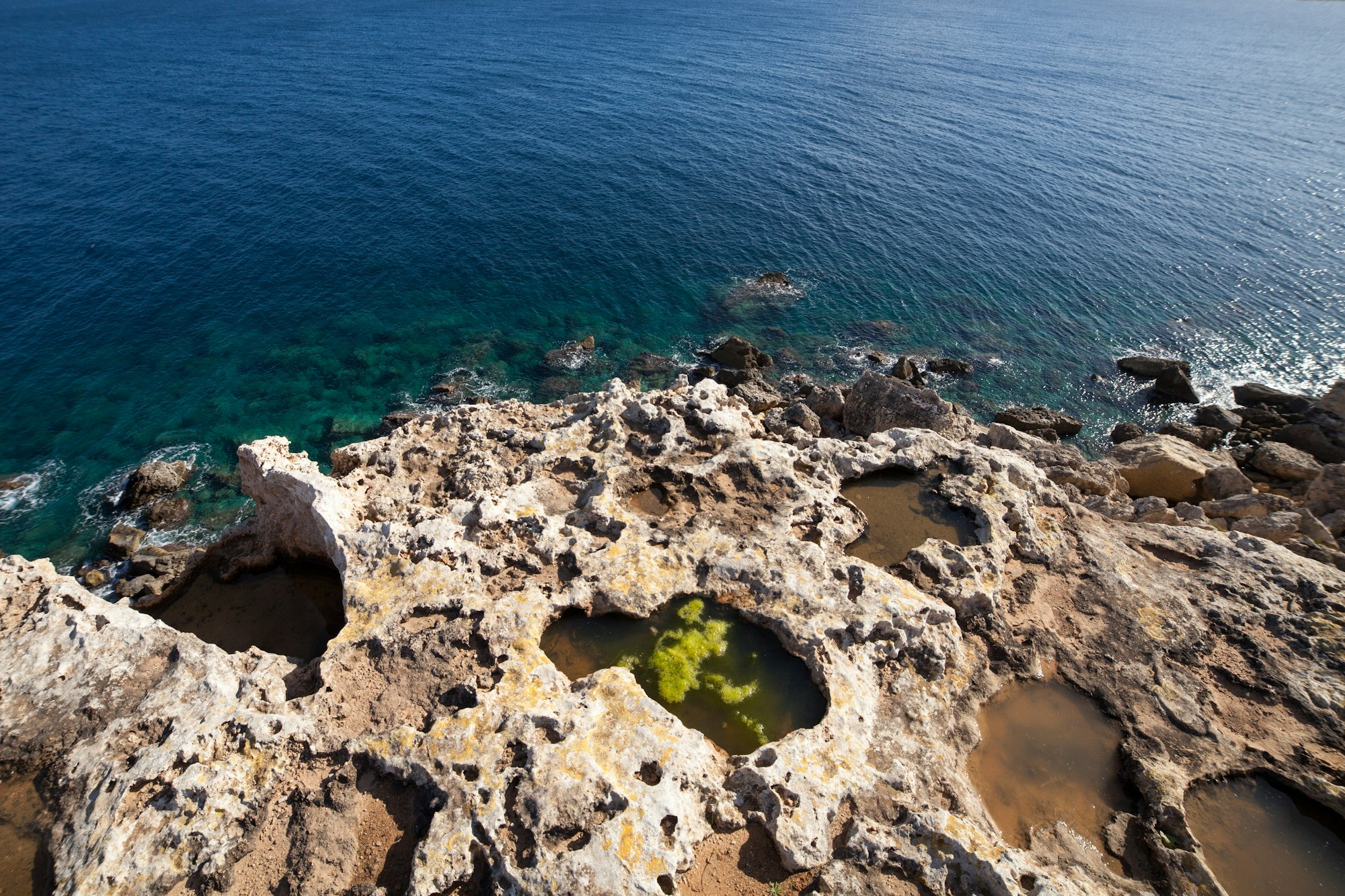
On a clear, sunny day you’ll be able to see Malta’s sister island of Gozo with its white chalk cliffs shining brightly in the distance. It’s a fantastic site so make sure you stop after an hour or so for a quick break to take it all in.

The first major landmark you’ll reach is the Fort Bingemma, just one of the many old forts connected by the large stone walls.

To get here from the start point in Kuncizzjoni you’ll have to ignore the signs scattered around which say ‘private’. Locals tend to put these up everywhere to scare people off but the Victoria Lines route is a public right of way so, don’t be shy and push on!

The path will take you down into the valley and then back up again towards the imposing fort when you rejoin the wall.

This first section is the least well maintained and can become quickly overgrown in the springtime. It’s the hardest bit to navigate but will get easier from here on, we promise.

This map shows the first little section of the route up to Fort Bingemma:

Fort Bingemma is an ideal spot to stop and soak up the tranquillity and views from here.

The Bingemma Gap

The walking route now becomes easier to navigate and more obvious as you head on towards the Bingemma Gap. Simply follow the wall, for the most part, swerving around a few houses built into the wall when you need to.

After the gap, you’ll soon reach the famous Dwejra Lines section. The start of this stretch is known by the locals as the ‘Great Wall of Malta’ and it’s easy to see why. As you cross the bridge like a wall here make sure you investigate the nearby caves carved deep into the imposing rock face.

Victoria Lines Malta - Dwejra Lines section

The walk beyond takes you along a high ridge which offers stunning views right across the north of the island. There’s an old gun placement at the start of this section which makes a great lunch spot!

Then you’ll soon be dropping back down towards the City of Mosta with its iconic Rotunda cathedral dome. Here the route will cross a main road for the first time and the traffic noise can come as a shock after so long in the peaceful Maltese wilderness.

This can make a good spot to end the walk. Just turn right into Constitution St when you hit the Gharusa Bus Stop. This road will take you to the centre of Mosta for a well-earned drink, snack or bus home.

If you want to carry on the trail, just cross over the road into Triq Misraħ Għonoq and you’ll soon pick up a well-maintained section of the wall.

 Victoria Lines Trek in Malta

At the end of this section is mighty Fort Mosta. Even today, this is a mighty and imposing structure which makes it very difficult to carry on the walk.

Our suggestion here would be to call it a day. We had a really tough climb around the outside walls of the fort, along a narrow ledge at times, not really recommended.


Other fun activities to try in Malta and Gozo…


Best Time to Walk the Victoria Lines

 Victoria Lines Malta. Best Time to walk the Victoria Lines

Unless you really love heat exhaustion we would suggest you don’t attempt the walk between late May and late October. The sun is incredibly strong in Malta and would be pretty unbearable, especially on the exposed stretches, even with a cooling breeze.

Then as the heat cools towards the end of the year the countryside is still pretty dry and dusty until the winter rains come. So, although much more bearable, the views in autumn and winter just won’t be as good as they are in the Maltese springtime.

We walked the Victoria Lines in early April. At this time of year, the Maltese countryside is still mostly lush and green with lots of flowers coming into full bloom. Between January and April is the optimal time to enjoy this epic walking trail we’d say.

Preparing for the Victoria Lines Malta Hike

 Victoria Lines Trek in Malta. Preparing to walk Victoria Lines

Today some sections of the original fortifications survive and a few have been restored but be prepared for some tricky or overgrown sections along the way. It’s not suitable for prams or wheelchairs unfortunately and can get pretty rugged underfoot in places so wear good trainers or walking boots.

Of course, pack plenty of water and some snacks or sandwiches. Most of the route isn’t near a shop or cafe and you’ll certainly work up a thirst.

Good suncream and a hat is always a must. We’re not your parents but the sun can burn you pretty quickly in Malta, especially in the wind when you don’t notice the heat as much!

Also, don’t forget your camera. Some of the views to the north and south of the island are stunning from the high sections. Malta is a pretty flat island so you’ll get a truly unique perspective from this hike.

Finally, don’t forget your smartphone with good old Google maps or similar. Pin as many of the above locations in the app as you can before you set off. It’s easy to lose the trail in places, so this was a big help for us. Using the terrain or satellite view also helps you locate the natural ridge of the walking trail.

For more ideas, check out our essential travel gear. We don’t go anywhere without most of them!

Victoria Lines Malta FAQs

Where is the starting point of the Victoria Lines?

You need to navigate to the coastal village of Kuncizzjoni to begin a walk along the full length of the Victoria Lines. However, you can drop in and out at any point along the route.

How long does it take to walk the Victoria Lines?

It's best to allow at least half a day if you want to walk the entire route. An hour or two is enough to do the main middle section.

When is the best time to walk the Victoria Lines?

It makes a pleasant walk in the Maltese winter or spring. Once it reaches May it can be too hot in the day to enjoy this countryside walk.

Is it easy to walk the Victoria Lines?

The middle section is the easiest bit to navigate. Other sections are overgrown or totally unsignposted. Use our map to help you.

Have you attempted the epic Victoria Lines Malta walking route? Are you planning on hiking it? Questions about this walking trail? Let us know in the comments below… 

The Victoria Lines, Maltas Epic Hiking Trail
The Victoria Lines - Epic Hiking Trail in Malta

You might also enjoy:

22 Comments

  1. Hi there, the victoria lines end at fort Madliena which is way off where you stopped. From Mosta you get to gharghur then Madliena. It might be nice to mention this in your blog.

    1. Hi Malcolm, I would have added that but it became impossible to follow any kind of decent trail once we’d reached the turnoff to Mosta so didn’t want to include this. I think the section we did is the most scenic and the one the majority of people will be able to follow easily. Even then you have to be careful with all the signs saying ‘private property, keep out!!’.

  2. We would like to hike a portion of the middle of this trail (“Bang for buck”) but are finding it really difficult to learn where to access the trail, especially in conjunction with the bus system. We would really appreciate any advice. Would it make sense to catch a bus to Bingemma, and then hike to Mosta? How long would that hike take? Where/how do we join the trail and then also end up at another bus stop? Thanks in advance for any assistance. (Visiting from Vancouver Island, Canada)

    1. Hi Michael, head to the section starting here and go inland https://goo.gl/maps/1JcVdhzRizuttx4B6. This is the clearest starting point and easiest to follow. It’s a real shame that the Maltese don’t maintain this trail, it could be a great walk if it were cleared and signposted properly. Instead, they just put up signs saying no trespassing when it’s not even their land!

  3. I had other plans for today but met a couple in Bahrija who were going to do this… I decided to join them and walked until I reached Gharghur! Even following the page linked, we often felt like we were off-track and would lose sight of the wall. Was fun still!

  4. Wow, I had no idea Malta was home to such an amazing hiking route – and the history behind it is fascinating! Plus, those are some incredible pictures – definitely adding this to my hiking bucket list.

    1. Thanks so much! The trail is great, we really enjoyed it! There are also some great trekking routes in Gozo that need checking out sooner rather than later! 🙂

  5. Hi everybody!
    Thank you for this post!
    The Dwejra/Victoria lines are a beautiful and a great hike!
    But…
    Did other hikers also notice the amount of litter on the route?
    I think it is terrible and it can really decimate the joy I have from a great walk out there…
    Now there is something we can do about it! Just pick it up!
    Come to the clean up on 22 April 2018 and help us restore this beautiful spot!
    Find the latest information on facebook:
    https://www.facebook.com/events/1507198192921058/
    Hope to see many enthusiasts like all of you!
    Jeroen

    1. What a good idea! I did the trail today and really think it would benefit a good cleaning and it would be so nice if Malta tried to facilitate the route with more infos etc!

  6. I first walked the Victoria Lines more than thirty years ago on my very first visit to Malta. In October of this year I re-walked the route from Mosta to the West Coast. The thirty plus years have certainly taken their toll with respect to trail deterioration and overgrowth. On both occasions I used the path which runs on the north edge of the Dweira defensive entrenchment and the now non existent wall. I’m in my seventies and found this route to be almost impassible, due to overgrowth and trial proximity to steep drop-offs. Thirty years ago it was relatively clear. I live on Gozo and spend a lot of time hiking, mainly on Gozo which has some incredible trails, However, even thirty plus years on, the magic of my first hike on the Victoria Lines was undiminished, Anyone wanting to undertake this hike should first spend some time studying the history of the fortifications and route options. I would, unless looking for an additional challenge, recommend staying clear of that trail section on the north edge of the Dweira entrenchments. This path shows on many maps, but the track which runs south of the entrenchment is the safer option.

    1. More on the Victoria Lines Walk

      I just wanted to expand on my comment above.

      First a little more information about the forts:

      Fort Madelaina is owned by the government and falls under the responsibility of the Armed Forces of Malta. It is leased to the St John Rescue Corps., and is used as their headquarters and training school. This fort is open to the public on Saturday afternoon and by appointment during the week.

      Fort Mosta, also owned by the Government, is used by the Armed Forces Malta as an ammunition store. The Dog Section of the Malta Police Corps is also housed within this facility. Since it is still used by the army and police, the fort is not open to the public. It is constructed on the site of a Bronze-age Citadel and Village.

      Fort Binġemma, is also owned by the Government but has been illegally occupied (by prior tenants) since 2009 and is currently protected by dogs and an iron gate. Previous to the building of the fort there was a Roman city or village on the site. There is hope that the facility will be retaken and open to the public at some time in the future. Of the three forts this has the most imposing position. However it does have an air of neglect.

      In my first note I made mention of having hiked to the coast, but did not elaborate further. After arriving at Kuncizzjoni I continued to walk through Bahrija to Fomm ir-Rih, from where, after enjoying the incredible views, I walked to Mgarr. It’s just a personal opinion; but I think that the best part of the hike is from the start of the Dweira Lines section through to Fomm ir-Rih, This would also make a good circular walk with Mgarr as a start and end point. There is a small store at Bahrija and Mgarr has restaurants, stores and a reasonably good bus service.

      1. Hi David, thanks so much for taking your time to leave your insightful comments on our blog! It’s always nice to have a local perspective. Your comments will be a great addition to the article. I am sure our readers, just like us, will find it very useful and interesting.

        We completely agree with you that Victoria Lines is “Jewel in the Crown of the Maltese hiking trails”. This was our first hike in Malta and we really enjoyed it. Hopefully we will be back to Gozo to do some hikes next year 🙂

        1. I sincerely hope that you do get to Gozo and hike some of our trails, many of which provide fantastic coastal cliff panorama’s. This Island may be small but believe me it is still possible to hike for two or more hours and not encounter another human. It also lends itself to good circular hikes, of three or so hours, which can range from moderate to challenging. Gozo is also much quieter than Malta; for me these Island are a walkers paradise, I do walk in the summer months but then hike early morning and evening. I have many, many, years ago hiked the Pennine Way in the UK as that was the place of my birth, I lived and worked in northern Italy for a while and enjoyed Alpine walking. I also spent twenty five years in the USA and hiked parts of the Appalachian Trail. But for me nothing beats the Maltese Islands for short to full day hikes. Even if I walk the same route numerous times I always find something new to pique my interest.

          1. Wow, that sounds amazing! Looks like you’ve hiked in some pretty awesome places! Good to hear that you are still active and hiking!

            We’ve been to Gozo a few times for a quick visit and we really like it, but haven’t done any walks yet. Will definitely plan something for next year or maybe even before the new year if it’s not too rainy ha ha!

      1. Marie, I have recently completed the Mosta to West Coast section of the trail in four hours eighteen minutes and then, from there, walked to to Mgarr to catch a bus to the ferry terminal and my home Island of Gozo. As previously noted, this is, by Maltese standards, a long walk: but I’m in my seventies and didn’t have a problem. However, it is probably a good walk to split into two sections with a few days between sections. Although I love hiking on Gozo, for me the Victoria lines, which I first hiked more than thirty years ago, remains the “Jewel in the Crown” of the Maltese hiking trails. I do so hope that you give it a try, the views are incredible and on my hike in October I walked for more than three hours before encountering another walker.

  7. I enjoyed this post. I have never hiked Malta’s trail but it looks amazing. I liked how you mentioned the sunscreen because I forgot one time and it was not pretty! lol. Also, those sandwiches look good!

    1. Hey Kyle, glad you liked the post! The trail is pretty epic for such a small island like Malta. Sandwiches always taste better with a view, don’t they 🙂

Leave a Comment...