Top Tips For Hiking Lang Biang Mountain in Da Lat, Vietnam
The tallest of three peaks near Da Lat, Lang Biang offers sweeping panoramic views over Vietnam's Central Highlands. Here are our practical tips for hiking it: trail start point, difficulty, tickets, transport and what to expect on the climb.


Located in Lac Duong District, Lang Biang, the tallest of the three peaks near Da Lat offers sweeping panoramic views across the Central Highlands. However hiking Lang Biang peak in Da Lat can be slightly challenging.
The 4 km vertical climb will leave you out of breath but the trek is worth the challenge. In this quick guide, we'll tell you where to start the hike, what to expect and how to get there.
Bookings: Some of the links in this article are affiliate links. This means that if you choose to make a booking, we will receive a small commission at no extra cost to you. Thank You!
🛵 Rent a scooter to explore the area freely. Compare prices and book directly below:
How to Get to Lang Biang Mountain
Located 12 km from Da Lat centre, Lang Biang Mountain can be reached easily by bike, motorbike, local bus, or taxi.
If you are planning to travel to the base of the mountain on a bike or scooter, you can leave your transportation parked at one of the stalls just outside the park. The friendly locals will look after them for a small fee.

Reach Lang Biang on a Local Bus
For around 12,000V VND, you can take the local bus #5 (look for Lang Biang written on the bus windows). It leaves from Da Lat bus station near the central market every hour from 6 am - 5pm. The ticket lady might also give you a piece of paper with the bus return hours which is handy.
After around 45 minutes up to an hour, you'll conveniently be dropped off by the main entrance to the national park.
Locate the Lang Biang Hiking Path
For the western travellers, Da Lat is all about nature, the hills, the national park and trekking. And as independent as we are, we decided to find our own way up to the tallest peak in the area.
If you, however, opt for the visit to the old radar station (1,950 m), you can take one of the old Russian jeeps violently whizzing the tourists up and down the paved path. At the top, there's a coffee and crafts shop, and more silly photo opportunities.
Do you need to buy a ticket for visiting Lang Biang mountain?
It's not really clear whether you need to buy a ticket or not if you are going to hike the peak. Most likely, the pass is needed only if you are going to see the Holywood-style Lang Biang sign in the park. And take pictures with horses painted to look like zebras. Don't ask!
But we bought ours anyway (around 20,000 VND - less than 1$) at the ticket booth on the left-hand side by the main entrance. Further down the path, there's another checkpoint so beware that in high season, someone might demand to show the ticket.
Where does the Lang Biang peak hike start?
To avoid being run over by the touristy jeeps, take the quiet and picturesque path through the beautiful pine-tree forest.
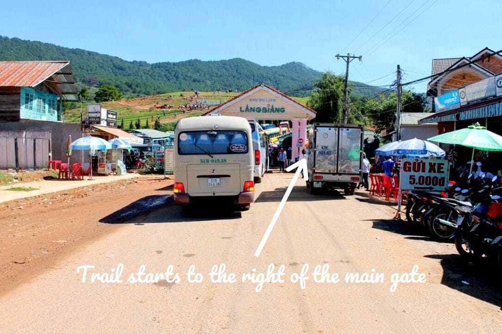
At the entrance, DON'T go through the main gate. Instead, take the narrow path to your right-hand side right outside of the main entrance (as shown in the photo above).
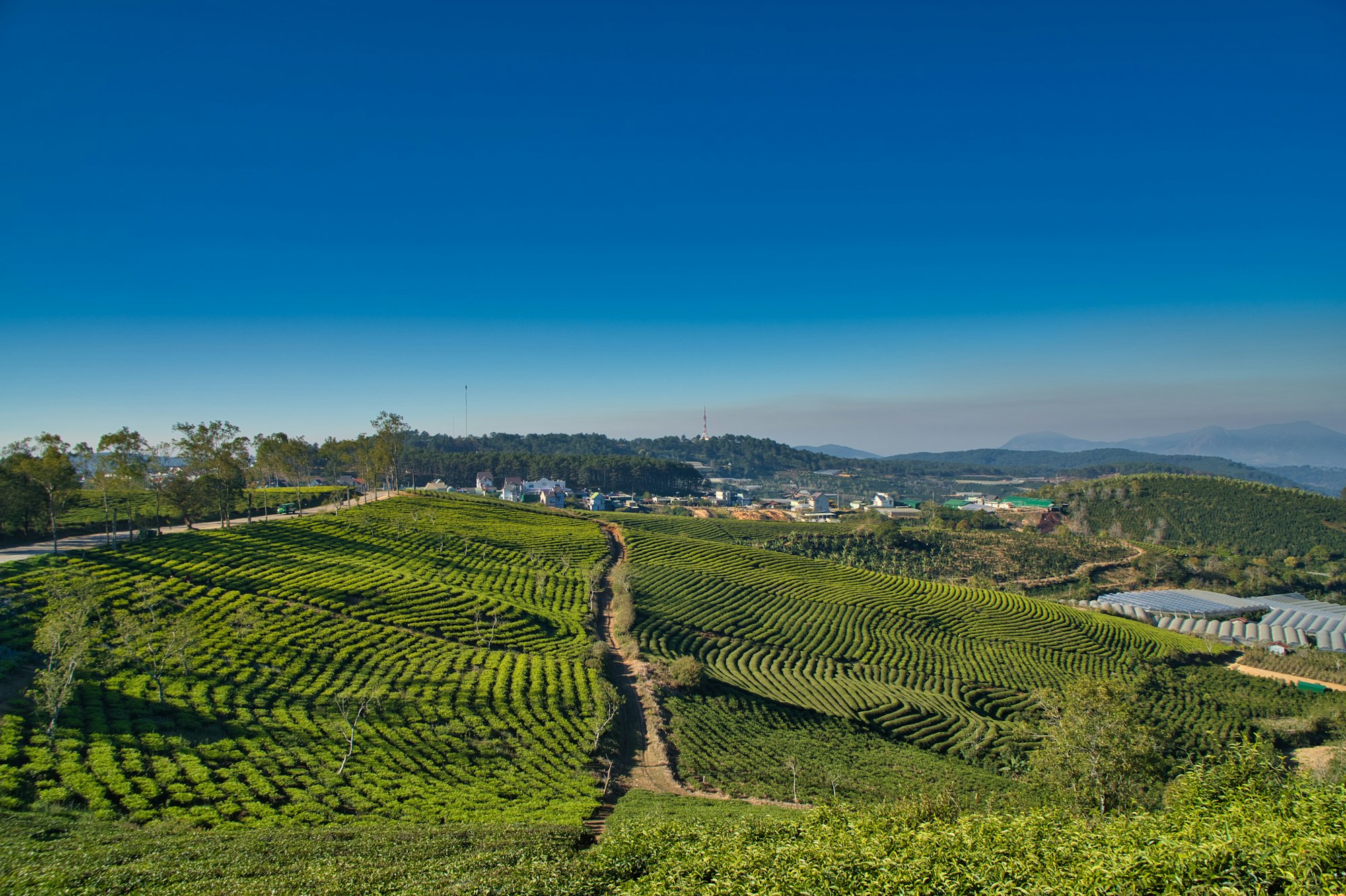
The path, depending on the time of year, can be muddy and may not look like a path, but it is. It will lead you into the national park through the strawberry fields, veg greenhouses and a coffee plantation.
If in doubt, ask the locals. They are used to people hiking up this way. It's safer than the main road and more peaceful too.
Once in the forest, follow the steep path up until you see the main road. The up-hill trek, depending on your fitness level, takes approximately 2-3 hours.
Unfortunately, you will have to step onto the main road for around 50 m or so to reach the base of the mountain. Once you see a large map in a wooden frame and a small wooden ticket booth, you know you are on the right path.
TOP TIP: Be sure to have some cash with you on the Lang Bang peak hike. During the high season, you might need to pay a small additional fee (20,000 VND, less than 1$) to access the path to the tallest peak in the area.
Lang Biang Mountain Trail Map
Below is a Google map of the Lang Biang walking trail to the summit. The start point pinned here is a small restaurant right next to the entrance gate.
Ignore the time stated, it's a pretty steep climb in places and is likely to take longer than this so allow plenty of time.
Prepare for the Lang Biang Peak Hike
First things first have a good breakfast. The hike will take at least half of your day so you'll want to make sure you have a hearty breakfast before leaving.
Alternatively, you can buy some food at the entrance to the park. There are a few places in the car park or just outside the gate to buy coffee, water and Bánh mì (baguette sandwich).
Wear comfortable footwear and take a rain jacket or a jumper. The weather can change quickly as you hike. It's also windy and cold at 2,167 m above sea level.
Be sure to pack snacks, but nothing too salty and plenty of water. The climb is steep and sweaty so you will want at least a 1l bottle if not more per person.
What's it Like to Climb the Tallest Peak in Da Lat
If you are not used to hiking, the Lang Biang peak hike can be a little challenging. But at the same time, the national park is beautiful full of greenery and panoramic views when the skies are clear.
As you progress climbing the mountain, it gets darker and the trek gets narrower leading you up through the jungle. The forest suddenly sinks into the soft fog. Luckily, it also gets cooler.
There are signs along the way to tell you how much you've got left to climb, but at times, we preferred not to know as the trek seemed never-ending. We were tired, sweaty and thirsty.
The most challenging bit is the last 360 m. At this point, the climb seems to take forever. But it's not the steep climb that's the most challenging here. It's the large steps that require a lot of effort and energy to move upward.
You are nearly at the top, just a few more steps...
Enjoy Langbiang at 2,167 Meters Above Sea Level
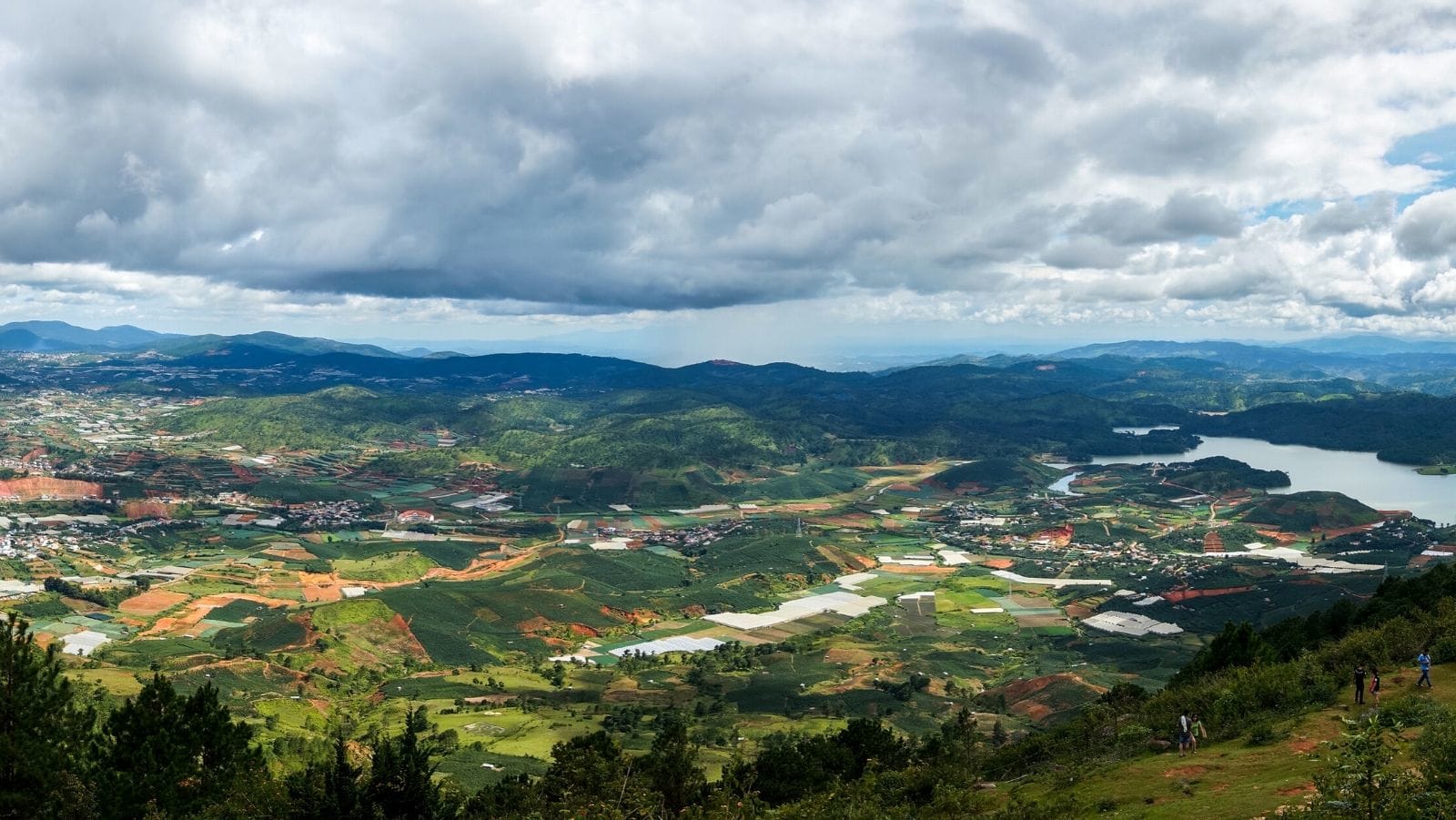
At the summit, if you are lucky, you'll see panoramic views across the Vietnamese highlights. But don't be disheartened to find the mountain covered in fog. It happens a lot.
Sit on the grass, catch your breath, relax. The fog will shift eventually.
The panoramic views of Da Lat might not be the most spectacular from the peak, but it's the challenge itself that's worth achieving.
TOP TIP: Be mindful when climbing down the mountain. These big steps can be hard on your knees so don't run or jump. Take it easy and enjoy the greenery.
Getting to Da Lat
As with many destinations in Vietnam, getting to Da Lat is pretty easy. One way to get there is to catch a local bus at HCMC, Bien Hoa, Nam Cat Tien, Phan Rang, Nha Trang or Buon Ma Thuot.
Alternatively, to save time, you can book a flight from Da Nang, Hanoi or Ho Chi Minh City.
We enjoyed our experience flying from Da Nang to Da Lat. The views from the plane were lovely.

During our Vietnam travels, we used the reliable 12Go.Asia website extensively to book bus, train and flight tickets and always had the best experience. Plus, you don't need to print your tickets, you show them on your mobile. Convenient!
Getting there
Lang Biang Mountain rises 30 minutes north of Da Lat, which itself is a short flight or 8-hour bus from Saigon (SGN). Most international travellers fly into SGN first, spend a couple of nights in HCMC, then take the morning Vietnam Airlines hop up to Da Lat for the cooler air and the trail.