Victoria Lines Malta Walking Trail – The Most Scenic Hiking Route
Hike Malta’s most scenic trail: the Victoria Lines. A 12km route through north Malta with ancient forts, dramatic views and expert hiking tips.


Where is Malta's best walking trail? It surely has to be the epic Victoria Lines Malta walking trail, a long-distance hike that follows the island’s historic defensive line from west to east across northern Malta.
As a walking route, it offers uninterrupted views over both the north and south coasts, with elevated viewpoints above the surrounding valleys. This guide focuses specifically on walking the Victoria Lines end to end, with practical context, landmarks, and conditions along the route.
Here’s what you need to know before setting out on this iconic Maltese walking trail. For a complete Malta itinerary, our guide to the best things to do in Malta and Gozo pairs perfectly with a day on the Victoria Lines.
Bookings: Some of the links in this article are affiliate links. This means that if you choose to make a booking, we will receive a small commission at no extra cost to you. Thank You!
What are the Victoria Lines?
The Victoria Lines are a 12 km network of British defensive walls and forts built across northern Malta along a natural geological ridge known as the Great Fault. Completed in 1897 — the year of Queen Victoria's Diamond Jubilee — they now form Malta's longest hiking trail.
Victoria Lines history
The 12km long Victoria Lines Malta trail runs along the top of a natural geographical barrier in Malta known as the Great Fault.
This natural ridge across the island has been used as a defensive barrier for hundreds of years.
The name Victoria Lines comes from the completion of a line of forts and defences along the route by the British in 1897, the year of Queen Victoria's Diamond Jubilee.
The line was built to protect the towns and harbours to the south from any invasions to the north across the wide-open lowlands.
Victoria Lines Malta - starting point
You can start at any point along the route but transport-wise it's best to begin from the western end of the trail and walk back towards the busier side of the island.
The closest bus stop to the Victoria Lines starting point in the west is Lellux - which is served only by the 109 bus. Coming from the direction of Valletta, you'll need to change to the 109 bus route near Rabat.
Use the nifty public transport route planner on Google Maps to plan your journey to Kuncizzjoni.
We had a hard time pinpointing the exact starting point in Kuncizzjoni. To make it easier, stand with your back to the church and head towards the stone wall for a view north over the valley.
Then turn right and you should be able to follow the route from there.
Use this handy map of the starting area to help you find your way to the start point from the bus stop:
To balance long walks like the Victoria Lines with lighter outings, here are a few popular experiences starting nearby.
Beginning the Victoria Lines Malta route
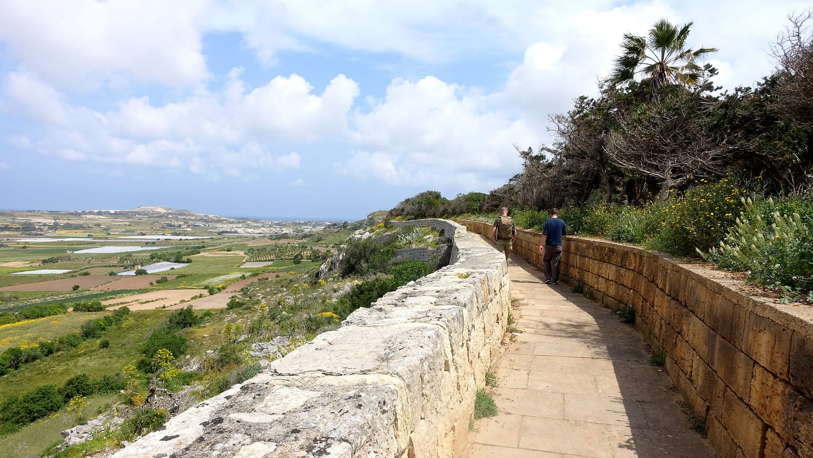
Once you get going, the route quickly becomes clear as the wall climbs uphill towards the east. For the most part, you can just simply follow the original wall and enjoy the views back towards Golden Bay and beyond.
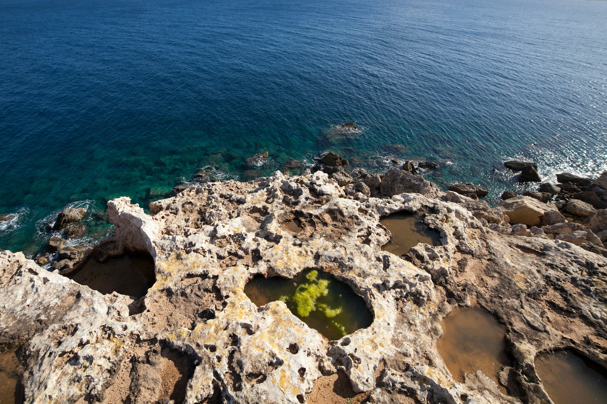
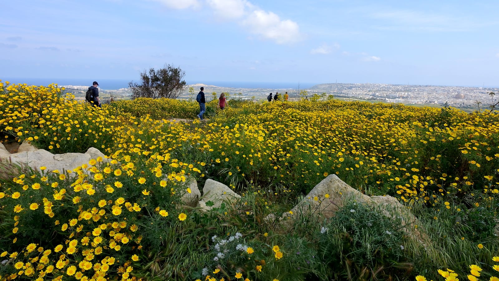
On a clear, sunny day you'll be able to see Malta's sister island of Gozo with its white chalk cliffs shining brightly in the distance. It's a fantastic site so make sure you stop after an hour or so for a quick break to take it all in.

The first major landmark you'll reach is Fort Bingemma, just one of the many old forts connected by the large stone walls.
To get here from the start point in Kuncizzjoni you'll have to ignore the signs scattered around which say 'private'. Locals tend to put these up everywhere to scare people off but the Victoria Lines route is a public right of way so, don't be shy and push on!
The path will take you down into the valley and then back up again towards the imposing fort when you rejoin the wall.
This first section is the least well maintained and can become quickly overgrown in the springtime. It's the hardest bit to navigate but will get easier from here on, we promise.
This map shows the first little section of the route up to Fort Bingemma:
Fort Bingemma is an ideal spot to stop and soak up the tranquillity and views from here.
The Bingemma Gap
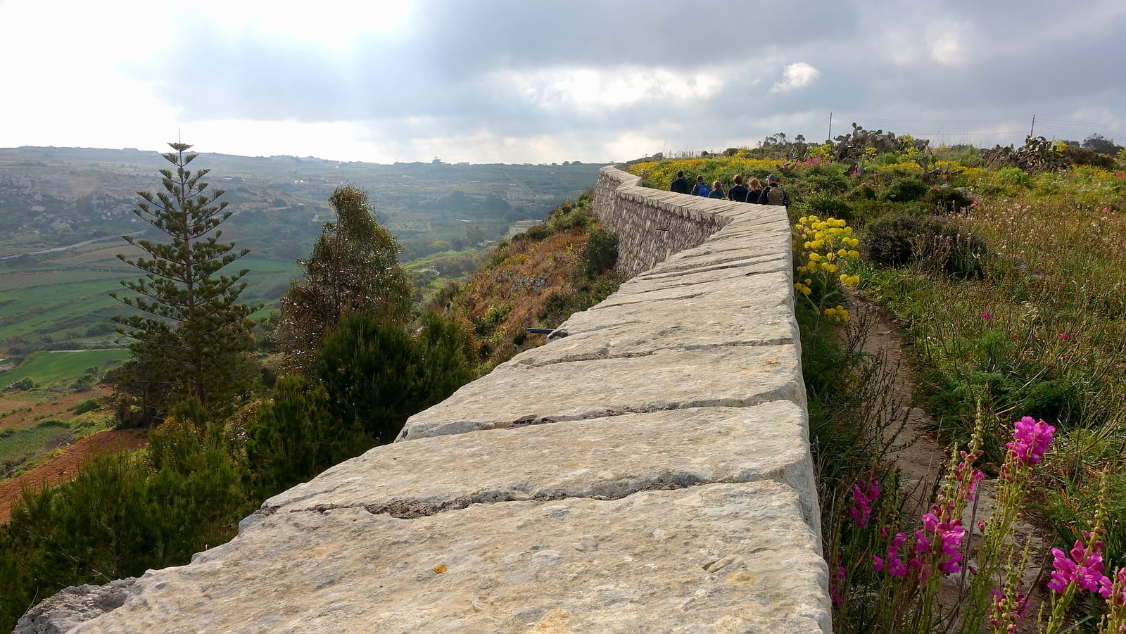
The walking route now becomes easier to navigate and more obvious as you head on towards the Bingemma Gap. Simply follow the wall, for the most part, swerving around a few houses built into the wall when you need to.
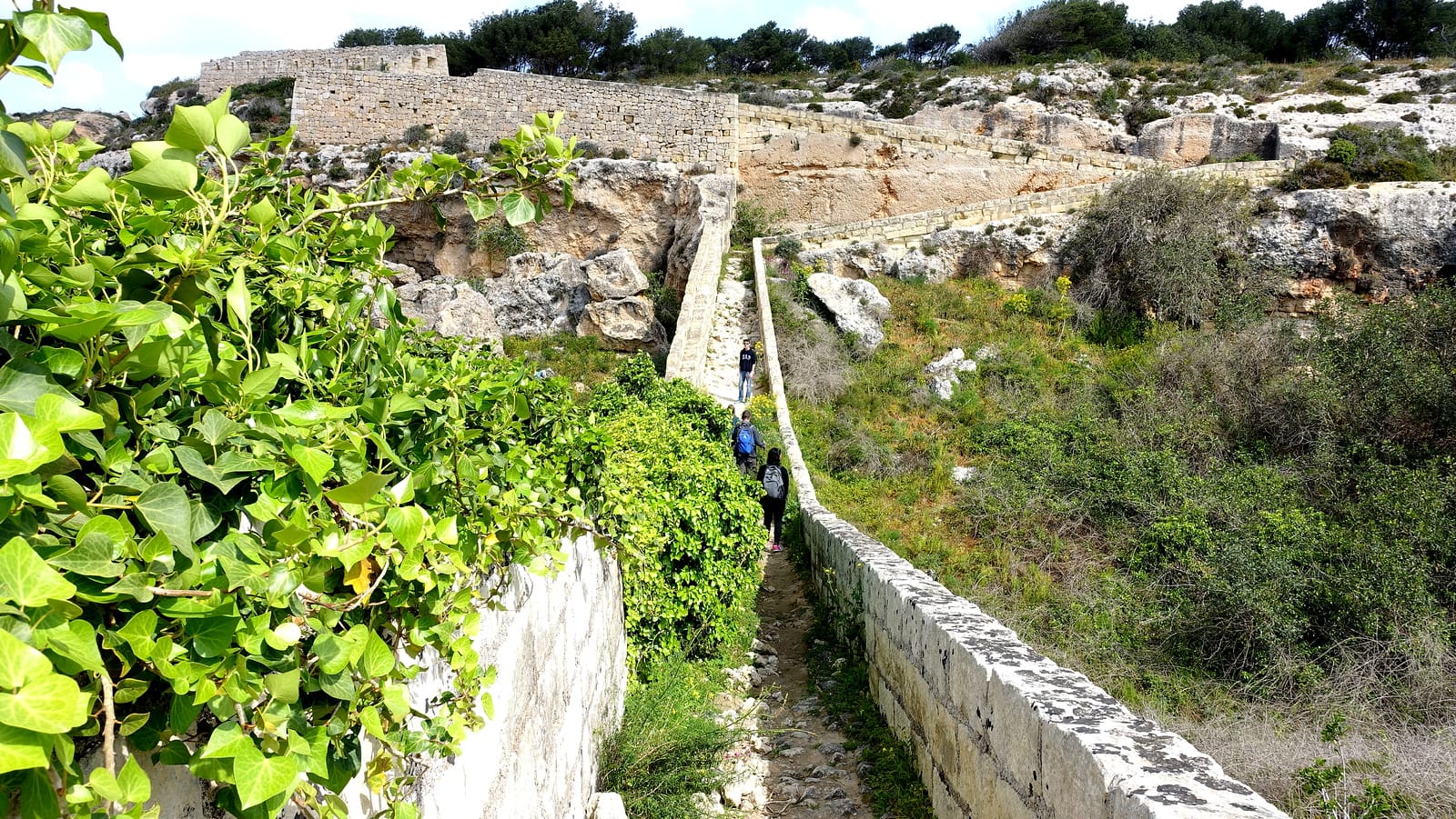
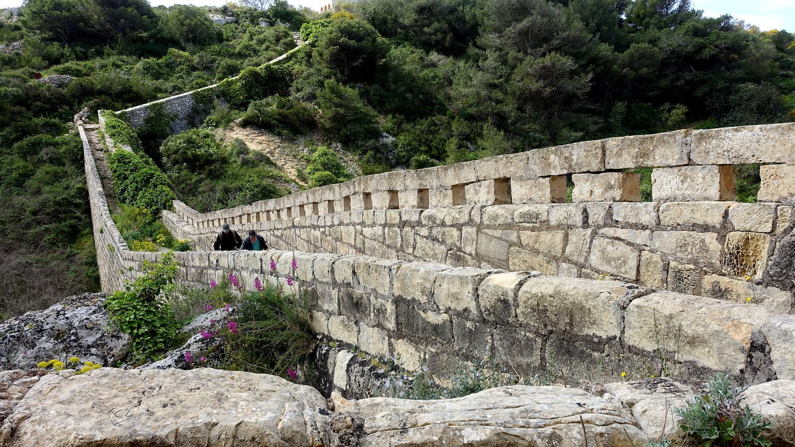
After the gap, you'll soon reach the famous Dwejra Lines section. The start of this stretch is known by the locals as the 'Great Wall of Malta' and it's easy to see why. As you cross the bridge like a wall here make sure you investigate the nearby caves carved deep into the imposing rock face.
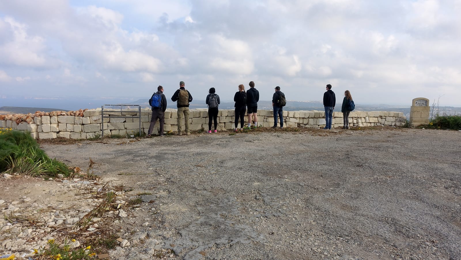
The route beyond takes you along a high ridge which offers stunning views right across the north of the island. There's an old gun placement at the start of this section which makes a great lunch spot!
Then you'll soon be dropping back down towards the City of Mosta with its iconic Rotunda cathedral dome. Here the route will cross a main road for the first time and the traffic noise can come as a shock after so long in the peaceful Maltese wilderness.
This can make a good spot to end the walk. Just turn right into Constitution St when you hit the Gharusa Bus Stop. This road will take you to the centre of Mosta for a well-earned drink, snack or bus home.
If you want to carry on the trail, just cross over the road into Triq Misraħ Għonoq and you'll soon pick up a well-maintained section of the wall.
At the end of this section is mighty Fort Mosta. Even today, this is a mighty and imposing structure which makes it very difficult to carry on free walking tour of Valletta.

We recommend finishing here. Circumnavigating the fort involves a steep climb along narrow ledges and is not generally advised.
After finishing the Victoria Lines walk, this is a good moment to slow things down and explore more of Malta’s best experiences at a more relaxed pace.
Best time to walk the Victoria Lines
Unless you really love heat exhaustion we would suggest you don't attempt the walk between late May and late October. The sun is incredibly strong in Malta and would be pretty unbearable, especially on the exposed stretches, even with a cooling breeze.
Then as the heat cools towards the end of the year the countryside is still pretty dry and dusty until the winter rains come. So, although much more bearable, the views in autumn and winter just won't be as good as they are in the Maltese springtime.
We walked the Victoria Lines in early April. At this time of year, the Maltese countryside is still mostly lush and green with lots of flowers coming into full bloom. Based on conditions, January to April offers the most balanced combination of temperatures and scenery.
Preparing for the Victoria Lines Malta hike
Today some sections of the original fortifications survive and a few have been restored but be prepared for some tricky or overgrown sections along the way. It's not suitable for prams or wheelchairs unfortunately and can get pretty rugged underfoot in places so wear good trainers or walking boots.
Of course, pack plenty of water and some snacks or sandwiches. Most of the route isn't near a shop or cafe and you'll certainly work up a thirst.
Good suncream and a hat is always a must. We're not your parents but the sun can burn you pretty quickly in Malta, especially in the wind when you don't notice the heat as much!
Also, don't forget your camera. Some of the views to the north and south of the island are stunning from the high sections. Malta is a pretty flat island so you'll get a truly unique perspective from this hike.
Finally, don't forget your smartphone with good old Google maps or similar. Pin as many of the above locations in the app as you can before you set off. It's easy to lose the trail in places, so this was a big help for us.
Using the terrain or satellite view also helps you locate the natural ridge of the walking trail.
Without proper footwear, the rocky sections of the trail become genuinely hazardous. Here’s the gear experienced Victoria Lines hikers rely on:
What to bring: a quick checklist
A short, practical pack list for the Victoria Lines (especially useful between January and April):
- Lightweight hiking shoes with good grip — for uneven rock and rough underfoot sections.
- Blister-resistant hiking socks — the easiest comfort upgrade for long walks.
- Blister plasters — small, cheap, worth having just in case.
- Small daypack (15-25 L) — for water, snacks, layers and your phone.
- Hydration bladder (1.5-2 L) or sturdy water bottle — you'll feel the heat and wind faster than expected.
- Electrolyte tablets — helpful on warm or windy days.
- SPF 50 sunscreen — the ridge is exposed for long stretches.
- Packable sun hat — shade and wind protection in one.
- Lightweight windbreaker / packable rain shell — ideal for breezy spring conditions.
- Power bank (10 000 mAh) — maps and photos drain batteries quickly.
The free PDF guide above includes this checklist on page 2 plus our hike-day notes.
Getting there
The Victoria Lines run east-to-west across northern Malta — fly into Luqa (MLA) and pick up the rental at arrivals; the trail head is 25 minutes by car from the airport. KM Malta Airlines and Ryanair fly direct from most European capitals; shoulder-season fares regularly come in under €60 return.
Renting a car for Malta hiking
The Victoria Lines start at Kuncizzjoni (west) and finish at Madliena Tower (east) — both reachable by bus, but a rental car makes side trips, dawn starts and "abort the hike, drive me home" moments much easier. We use Trip.com car rental in Malta for shorter trips (3-4 days, no insurance excess) and Discover Cars for longer multi-island hires (Gozo + Comino combo).
Where to Sleep Near the Victoria Lines Malta
The trail crosses three distinct zones of Malta. Here’s where to stay depending on your itinerary:
Golden Bay / Għajn Tuffieħa — West (Trail Start)
The most convenient base if you’re starting from the western trailhead at Kuncizzjoni. Golden Bay and Għajn Tuffieħa are among Malta’s most beautiful coastal areas — sandy beaches, clear water and a relaxed vibe make them ideal for unwinding after the hike. Several hotels and self-catering options sit within easy reach of the starting point.
Mosta — Centre (Accessible, Rotunda Cathedral)
Mosta is perfectly placed for walkers tackling the middle section of the trail, and works well as a central base for exploring all of northern Malta. The town is best known for its extraordinary Rotunda cathedral — one of the largest unsupported domes in the world — and it’s well-served by bus routes in all directions.
Valletta — East (UNESCO Capital)
If you plan to combine the Victoria Lines with time in Malta’s historic capital, basing yourself in Valletta or nearby Sliema makes excellent sense. The eastern section of the trail is easily accessible, and after your hike you’ll have the city’s grand architecture, waterfront restaurants and world-class museums right on your doorstep.
Get the free Victoria Lines trail PDF
A two-page printable guide — 10 waypoints with GPS, transport, gear list and our hike-day notes. Sign up free to unlock the download.
Already a member? Sign in to download. No spam — just the PDF + occasional Malta tips.
Frequently Asked Questions
Where is the starting point of the Victoria Lines?
The western starting point is the village of Kuncizzjoni in northern Malta. From there you can walk the full route eastwards. The closest bus stop is Lellux on the 109 bus from Rabat. You can also drop in and out at any point along the trail.
How long does it take to walk the Victoria Lines?
Allow at least half a day to walk the full 12 km route end to end. An hour or two is enough for the main middle section between Kuncizzjoni and Mosta.
How long is the Victoria Lines trail in Malta?
The Victoria Lines run for 12 km across northern Malta, following the natural ridge of the Great Fault from Kuncizzjoni in the west to Fort Mosta in the east.
Who built the Victoria Lines and why?
The British built the Victoria Lines as a defensive fortification along the Great Fault. The line of forts and walls was completed in 1897 — the year of Queen Victoria's Diamond Jubilee, hence the name.
When is the best time to walk the Victoria Lines?
Maltese winter or spring (November to April). From May the daytime heat makes the route unpleasant. Spring offers the greenest views; autumn is bearable but drier and dustier.
Is the Victoria Lines trail easy to walk?
The middle section is the easiest to navigate. Other sections are overgrown or unsignposted. Wear good trainers or walking boots, bring water, and use a map to stay on the route.
What is the Great Wall of Malta?
Locals call the Dwejra Lines section of the trail the 'Great Wall of Malta'. It's a tall stone wall section after the Bingemma Gap, with caves carved into the rock face nearby.
Can I do the Victoria Lines without a car?
Yes — the closest bus to the western start is the 109 from Rabat, stopping at Lellux. You can finish the trail near the City of Mosta where buses connect back to Valletta and the rest of the island.
What forts can I see along the Victoria Lines?
The main forts are Fort Bingemma (early in the route), the Dwejra Lines / 'Great Wall of Malta' section, and Fort Mosta at the eastern end. There are smaller gun placements and bunkers in between.
Is the Victoria Lines trail signposted?
Partially — the middle section is reasonably clear but other sections are overgrown or unsignposted. Some private property signs appear on the route but the trail is a public right of way. Pinning landmarks on Google Maps before you set off is recommended.
More Malta walks & guides on MapTrotting
Combine the Victoria Lines with our other Malta favourites:
- Free self-guided Valletta walking tour — 23 stops + downloadable PDF map (perfect for the day after Victoria Lines).
- Marsaxlokk Sunday market — fish, lampuki pies and luzzu boat photos.
- Things to do in Gozo — sister island day trip, ferry from Cirkewwa.
- The complete Malta + Gozo guide — 2 years of living on the islands distilled.
- Barbarossa sailing trip — Comino & Blue Lagoon by boat.
What to Do After the Victoria Lines Walk
After 4 hours of hiking, most visitors use the Victoria Lines as a launchpad into the rest of Malta. Here’s what pairs naturally with the trail:
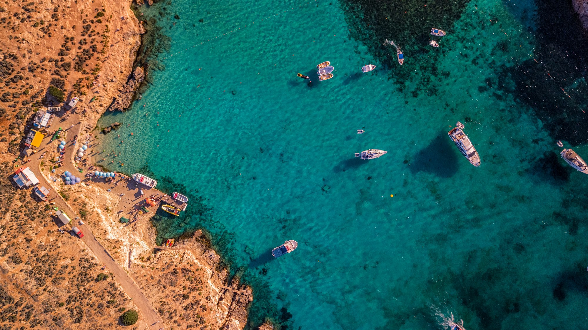
A Malta boat trip to the Blue Lagoon is the perfect reward after a long day on foot — turquoise water, sunshine and zero effort. Comino’s Blue Lagoon is only accessible by boat and remains one of the Mediterranean’s most spectacular spots.
Għawdex (Gozo), Malta’s quieter sister island, is just a 25-minute ferry ride away. A full day trip to Gozo delivers dramatic sea cliffs, ancient temples and great snorkelling — a natural complement to the more rugged Victoria Lines landscape.
History lovers will enjoy continuing with a self-guided Valletta walking tour. Malta’s compact UNESCO capital rewards a few hours on foot, with Baroque architecture, seafront views and excellent street food.
For authentic village life, the Marsaxlokk Sunday fish market is unmissable. This traditional fishing village on the south coast comes alive on Sunday mornings with fresh seafood, local produce and colourful luzzu boats lining the harbour.
Popular activities booked by Victoria Lines hikers: